Once installed it does not require any Internet connection. The map reacts quickly to simple gestures for zoom and pan.
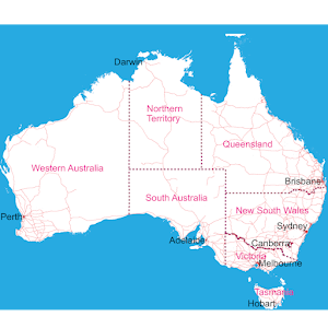
The top level is a map of Australia, below which there here are 4 more zoom levels. Shows highways, roads, and tracks many of which are named or numbered. It is not however suitable for use as a street map. Please see the sample screen shots for the level of detail provided.
It has a searchable gazetteer of over 36,000 place names and over 2,500 postcodes. A single, selected place or postcode code can be temporarily marked and then deleted.
It incorporates data which is © Commonwealth of Australia (Geoscience Australia) 2013. Postcode locations are from the Australian Bureau of Statistics 2011. This application is not endorsed by any government agency.
• Works anywhere without an Internet connection
• Easy to search for place names and postcodes
• Fast zoom and pan using simple gestures
• No advertising
• Context-sensitive help screens
Reviews for
Click Here to Read Reviews for >> Click Here to Submit Reviews for >>