It extends from Barnes in the west to Bow in the east and from Hornsey in the north to Dulwich in the south and covers over 150 square miles.
Shows London Underground, Docklands Light Railway and Railtrack stations.
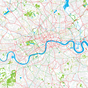
Easy, touch-screen, map selection. Panning across maps is supported by simple finger drag. The top zoom level is a London map and there are four zoom levels down to detailed street level – all in colour. At maximum zoom in, streets and their names are clearly visible. Please see the screenshots for the level of detail supported.
Once installed this application is completely stand-alone and does not use or require any Internet connection. As a result, it works anywhere including on the underground.
Contains Ordnance Survey data © Crown copyright and database right 2013.
Contains Royal Mail data © Royal Mail copyright and database right 2013.
Contains National Statistics data © Crown copyright and database right 2013.
This app is not endorsed by Ordnance Survey nor any other UK government agency.
Reviews for
Click Here to Read Reviews for >> Click Here to Submit Reviews for >>